
IndieCare AI supports Local Bodies, municipal corporations, and large industrial sites with scientific enumeration to map free-roaming dog populations on-ground. This baseline census helps plan vaccination and sterilization coverage, identify risk zones, and track progress over time through an organized, One Health–aligned database.
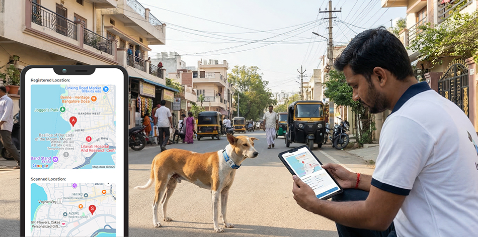
Structured, verified execution guaranteeing data integrity and animal welfare compliance.
Survey routes are predetermined across city wards, high-density zones (fish markets, crematoriums, stations), and industrial boundaries, traversed at consistent speeds (~20 km/h) during peak activity hours.
Equipped with the IndieCare AI Mobile App, field researchers capture photo records, physical attributes (age, gender, size, coat color), trap-shy/trap-eager behavioral traits, and precise GPS geolocation.
Computer vision algorithms process incoming dog photos to avoid double-counting free-roaming animals across adjacent survey sectors.
Municipal commissioners and site heads receive ward-wise, zone-wise demographic reports directly aligned with Animal Birth Control Rules 2023.
Need this service customized for your city ward or industrial premises?
Speak to an Operations Lead →By using GPS-tagged routes, timestamped photo logging, and computer vision facial and descriptor matching to detect duplicate encounters.
No. Only free-roaming stray community dogs are mapped and catalogued; household pet dogs are excluded.
Trained field enumerators supervised by veterinary coordinators and operations leads using standardized protocols.
IndieCare AI enables tagging and digital profiling through Dog Aadhaar ID so every dog can be identified individually.
IndieCare AI supports veterinary interventions by maintaining structured medical records and treatment updates.
IndieCare AI supports anti-rabies vaccination planning and execution by tracking who was vaccinated, where, and when.
Leave your details below and our operations director will reach out within 24 hours.